MILESTONES
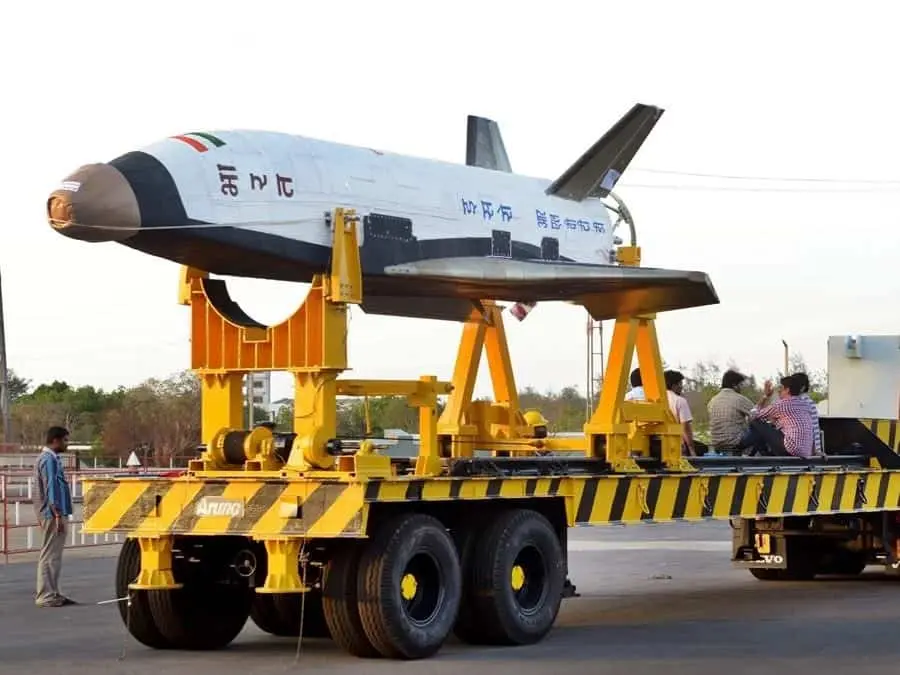
2016: India launches its first RLV-TD
The Reusable Launch Vehicle - Technology Demonstrator (RLV-TD) mission is a series of technology demonstration missions by the Indian Space Research Organisation (ISRO) to develop a reusable launch vehicle for low-cost access to space. The RLV-TD is a winged vehicle that can take off and land like an airplane, but can also fly into space.
The RLV-TD mission has four main objectives:
- Hypersonic aero thermodynamic characterisation of wing body
- Evaluation of autonomous Navigation, Guidance and Control (NGC) schemes
- Integrated flight management
- Thermal Protection System Evaluation
ISRO has conducted three RLV-TD missions so far, in 2016, 2020, and 2023. The first two missions were suborbital flights, while the third mission was a hypersonic flight. ISRO plans to conduct more RLV-TD missions in the future, with the goal of developing a fully operational reusable launch vehicle by the 2030s.
The RLV-TD mission is a significant milestone for India's space program. It demonstrates India's ability to design, develop, and fly complex space vehicles. The mission is also expected to lead to significant cost reductions in space access.
Here are some of the key benefits of reusable launch vehicles:
- >> Reduced cost of space access: Reusable launch vehicles can be reused multiple times, which can significantly reduce the cost of launching payloads into space.
- >> Increased launch frequency: Reusable launch vehicles can be launched more frequently than traditional expendable launch vehicles, which can enable new applications such as space tourism and rapid satellite deployment.
- >> Reduced environmental impact: Reusable launch vehicles produce less pollution than traditional expendable launch vehicles, which can help to reduce the environmental impact of space launch.
The RLV-TD mission is a critical step towards developing reusable launch vehicles in India. The successful completion of this mission will pave the way for a new era of low-cost and high-frequency space access.
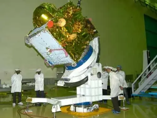
2014: India launches IRNSS-1A
IRNSS-1A is the first satellite in the Indian Regional Navigation Satellite System (IRNSS). It is one of the seven satellites constituting the IRNSS space segment. IRNSS-1A was launched on July 1, 2013, by a Polar Satellite Launch Vehicle (PSLV) from Satish Dhawan Space Centre (SDSC) SHAR, Sriharikota, India.
IRNSS-1A is a geostationary satellite, meaning that it orbits the Earth at an altitude of 35,786 km (22,236 mi) and remains above the same spot on Earth's surface. This makes it ideal for navigation purposes, as it can provide continuous positioning information to users.
IRNSS-1A carries two types of payloads:
- >> Navigation payload: This payload transmits navigation service signals to users. The payload operates in the L5-band and S-band.
- >> Ranging payload: This payload consists of a C-band transponder that facilitates accurate determination of the range of the satellite. IRNSS-1A also carries Corner Cube Retro Reflectors for laser ranging.
IRNSS-1A provides a variety of services to users, including:
- >> Positioning: IRNSS-1A can provide position information with an accuracy of up to 10 meters. This is useful for a variety of applications, such as vehicle navigation, land surveying, and disaster management.
- >> Navigation: IRNSS-1A can provide navigation information to users, such as speed and direction of travel. This is useful for a variety of applications, such as air navigation, ship navigation, and personal navigation.
- >> Timing: IRNSS-1A can provide accurate time information to users. This is useful for a variety of applications, such as financial transactions, telecommunications, and scientific research.
IRNSS-1A is the first satellite in the Indian Regional Navigation Satellite System (IRNSS). It is one of the seven satellites constituting the IRNSS space segment. IRNSS-1A was launched on July 1, 2013, by a Polar Satellite Launch Vehicle (PSLV) from Satish Dhawan Space Centre (SDSC) SHAR, Sriharikota, India. IRNSS-1A is a geostationary satellite, meaning that it orbits the Earth at an altitude of 35,786 km (22,236 mi) and remains above the same spot on Earth's surface. This makes it ideal for navigation purposes, as it can provide continuous positioning information to users. IRNSS-1A carries two types of payloads: Navigation payload: This payload transmits navigation service signals to users. The payload operates in the L5-band and S-band. Ranging payload: This payload consists of a C-band transponder that facilitates accurate determination of the range of the satellite. IRNSS-1A also carries Corner Cube Retro Reflectors for laser ranging. IRNSS-1A provides a variety of services to users, including: Positioning: IRNSS-1A can provide position information with an accuracy of up to 10 meters. This is useful for a variety of applications, such as vehicle navigation, land surveying, and disaster management. Navigation: IRNSS-1A can provide navigation information to users, such as speed and direction of travel. This is useful for a variety of applications, such as air navigation, ship navigation, and personal navigation. Timing: IRNSS-1A can provide accurate time information to users. This is useful for a variety of applications, such as financial transactions, telecommunications, and scientific research. IRNSS-1A is a critical part of India's navigation infrastructure. It provides a variety of services to users in India and the surrounding region. IRNSS-1A is also a significant milestone for India's space program, as it is India's first regional navigation satellite system.
2013: India launches its first interplanetary mission
The first interplanetary mission of ISRO was the Mars Orbiter Mission (MOM), also known as Mangalyaan. It was launched on November 5, 2013, and successfully entered Mars orbit on September 24, 2014. MOM was the first Indian spacecraft to orbit another planet, and India became the fourth space agency to achieve Mars orbit, after the Soviet space program, NASA, and the European Space Agency.
The primary objectives of the MOM mission were to:
- >> Demonstrate India's capability to design, develop, launch, and operate an interplanetary mission
- >> Study the Martian atmosphere, surface, and mineralogy
MOM was equipped with five scientific instruments:
- >> Mars Colour Camera (MCC): To take images of the Martian surface in color
- >> Thermal Infrared Imaging Spectrometer (TIS): To study the Martian surface composition and temperature
- >> Methane Sensor for Mars (MSM): To detect methane in the Martian atmosphere
- >> Lyman Alpha Photometer (LAP): To study the Martian hydrogen corona
- >> Martian Exospheric Neutral Composition Analyzer (MENCA): To study the composition of the Martian exosphere
MOM completed its primary mission objectives in six months, but it continued to operate in orbit for over eight years. During that time, it collected a wealth of data about the Martian atmosphere, surface, and mineralogy. MOM's data has helped scientists to better understand the Martian climate, geology, and potential for habitability.
MOM was a significant achievement for ISRO and for India as a whole. It demonstrated India's growing capabilities in space exploration and its commitment to scientific research. MOM also inspired a new generation of Indian scientists and engineers to pursue careers in space science.
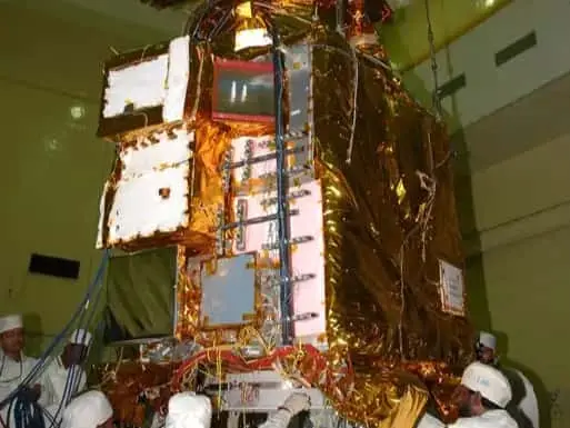
2008: India launches Chandrayaan-1
Chandrayaan-1 was India's first lunar exploration mission. It was launched on October 22, 2008, and successfully entered lunar orbit on November 8, 2008. The mission carried 11 scientific instruments, including a high-resolution camera, a spectrometer, and a radar altimeter.
Chandrayaan-1's main objectives were to:
- >> Map the lunar surface in high resolution
- >> Study the Moon's mineralogy and chemical composition
- >> Search for water ice on the Moon
The mission achieved all of its main objectives. It produced the most detailed maps of the lunar surface ever created, and it discovered water ice in the polar regions of the Moon. Chandrayaan-1 also made a number of other important scientific discoveries, including the detection of helium-3, a rare isotope of helium that could be used as a fuel for nuclear fusion reactors.
Chandrayaan-1 was India's first lunar exploration mission. It was launched on October 22, 2008, and successfully entered lunar orbit on November 8, 2008. The mission carried 11 scientific instruments, including a high-resolution camera, a spectrometer, and a radar altimeter. Chandrayaan-1's main objectives were to: Map the lunar surface in high resolution Study the Moon's mineralogy and chemical composition Search for water ice on the Moon The mission achieved all of its main objectives. It produced the most detailed maps of the lunar surface ever created, and it discovered water ice in the polar regions of the Moon. Chandrayaan-1 also made a number of other important scientific discoveries, including the detection of helium-3, a rare isotope of helium that could be used as a fuel for nuclear fusion reactors. Chandrayaan-1 ceased operating on August 29, 2009, after losing communication with Earth. However, the mission was a resounding success, and it laid the foundation for India's future lunar exploration missions.
Here are some of the key achievements of the Chandrayaan-1 mission:
- >> Produced the most detailed maps of the lunar surface ever created
- >> Discovered water ice in the polar regions of the Moon
- >> Detected helium-3 on the Moon
- >> Made a number of other important scientific discoveries
Chandrayaan-1 was a major milestone for India's space program, and it demonstrated India's ability to design, develop, and launch complex space missions. The mission also made a significant contribution to our understanding of the Moon.
2001: India launches GSAT-1
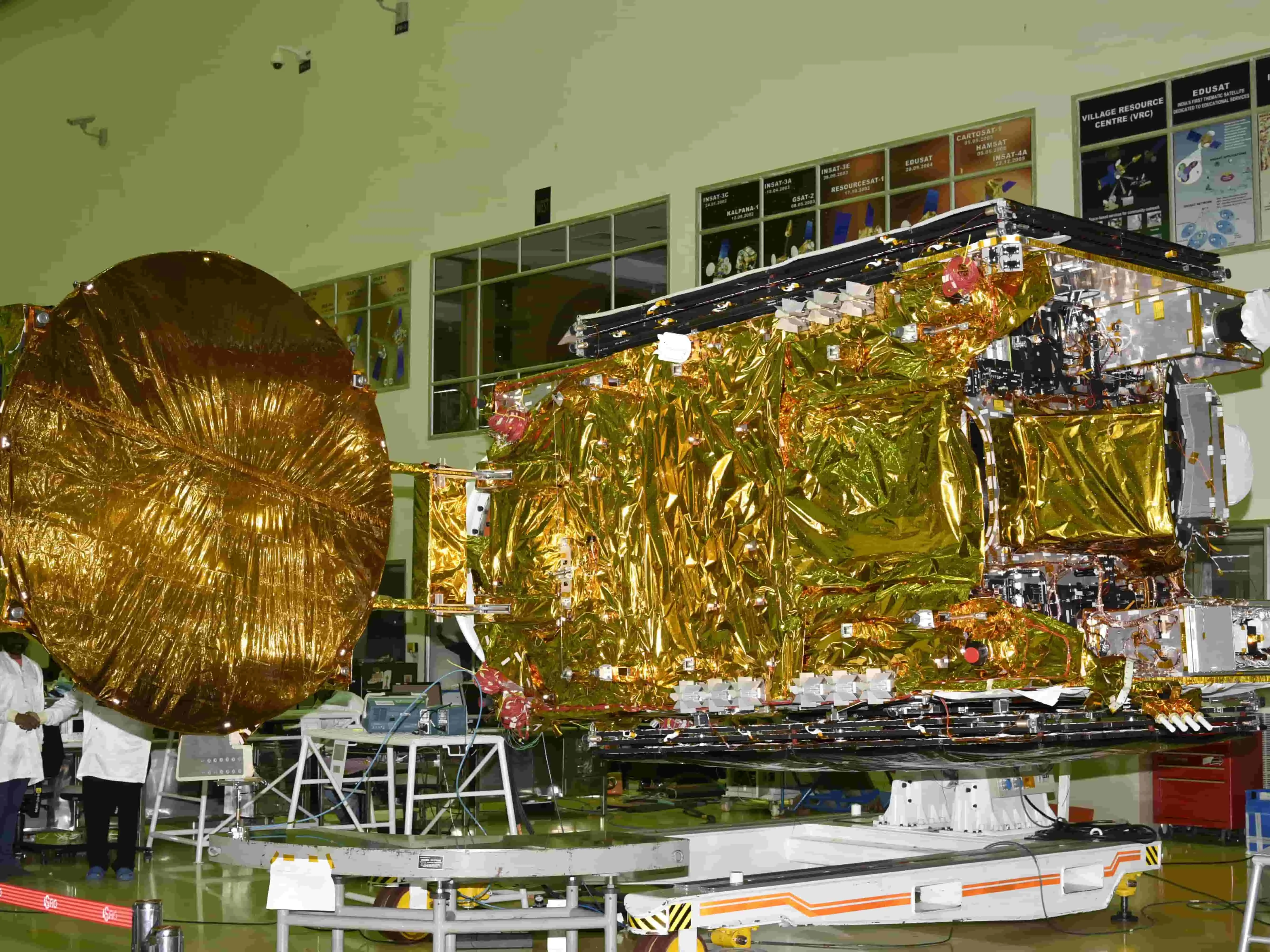
GSAT-1 was the first Indian experimental geostationary communication satellite. It was launched on April 18, 2001, by the maiden flight of the Geosynchronous Satellite Launch Vehicle (GSLV). The satellite carried three C-band transponders and one S-band transponder.
The main objectives of the GSAT-1 mission were to:
- >> Test the GSLV launch vehicle
- >> Demonstrate the capability of developing and operating geostationary communication satellites
- Conduct communication experiments
The GSAT-1 mission was partially successful. The launch vehicle was able to place the satellite in orbit, but the satellite was unable to reach its planned geostationary orbit due to a problem with its propulsion system. However, the satellite was able to carry out some communication experiments, including digital audio broadcast, internet services, and compressed digital TV transmission.
Despite the partial failure of the GSAT-1 mission, it was a significant milestone for ISRO. It demonstrated India's capability to develop and launch geostationary communication satellites. The mission also provided valuable lessons that were used to improve the design and development of subsequent GSLV launches and GSAT satellites.
The GSAT-1 mission was a stepping stone for ISRO's successful geostationary communication satellite program. Today, ISRO is one of the leading providers of geostationary communication satellite services in the world.
1994: India launches IRS-1A
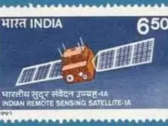
The Indian Remote Sensing (IRS) satellite programme was conceived in the late 1970s to build a self-reliant capability for remote sensing in the country. IRS-1A was the first satellite in this series, and it was launched on March 17, 1988, from the Baikonur Cosmodrome in Kazakhstan.
IRS-1A was a polar sun-synchronous satellite, meaning that it orbited the Earth at an altitude of about 900 km and crossed the equator at the same local time each day. This made it ideal for remote sensing applications, as it allowed for consistent and repeatable data collection.
IRS-1A carried two linear imaging self-scanning sensors (LISS) cameras: LISS-I and LISS-II. LISS-I had a spatial resolution of 73 meters, while LISS-II had a spatial resolution of 36.25 meters. Both cameras had a swath width of about 140 km.
IRS-1A was a major milestone for India's space program, and it played a significant role in the development of the country's remote sensing capabilities. The data from IRS-1A was used in a wide range of applications, including agriculture, forestry, water resources management, and disaster management.
IRS-1A completed its mission in July 1996, after serving for over 8 years. It was succeeded by a series of other IRS satellites, which continue to provide valuable data for a wide range of applications.
The IRS-1A mission was a significant success, and it helped to establish India as a leader in the field of remote sensing. The data from IRS-1A has been used to improve the lives of millions of people in India and around the world.